Hi!
Recently I started adventure with Grasshopper and its modules. Untill i tried to perform radiation analysis everything was going quite smooth. But on this point I am struggling for some time. Results of calculations are incorrect and this is why I decided to ask for help in solving this issue.
I tried to find the answer on Rhino forum, but @Wim suggested to post this on Ladybug component due to lack of connections with Rhino and involve @Mostapha. So here I am! 
But let’s start with the details:
-
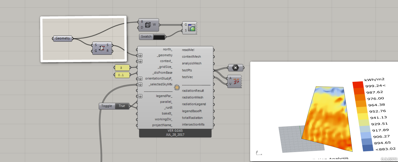
Purpose - I want to visualize the distribution of solar radiation on uneven surface obtained from aerial survey.
-
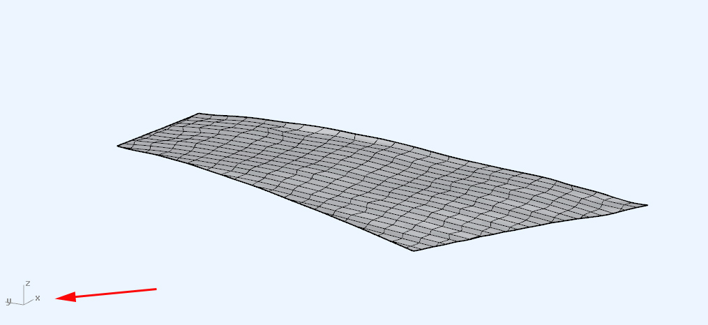
Object - imported to Rhino as .dxf contours, patched to form of surface and trimmed.
-
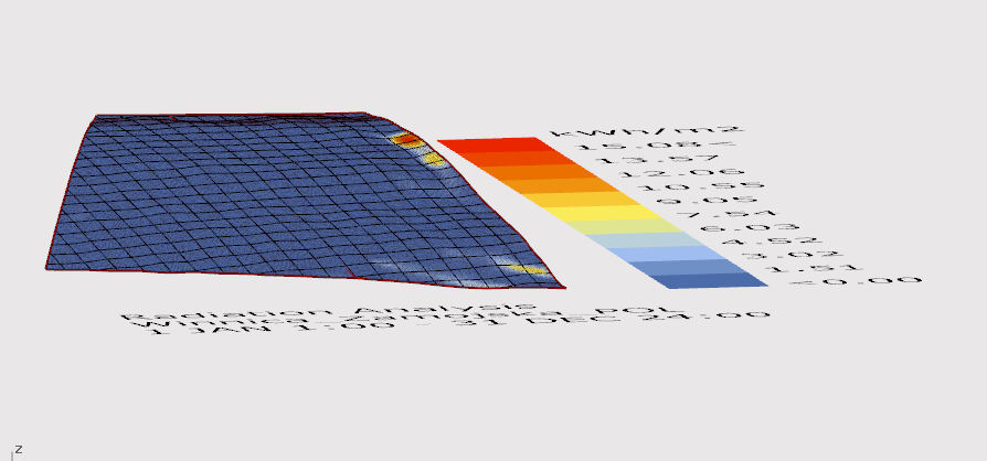
Problem – While I was able to correctly position the sunpath, or radiation rose on the imported geometry, it was not possible to properly visualize the radiation distribution on it.
Since the surveyed plot is located in Poland, I used an .epw file for nearest town and expected values provided by i.e. Solargis. And this is where the problem lies…
Values calculated and displayed by the algorithms are incorrect. Numbers visible on the graphic below were calculated for entire year.
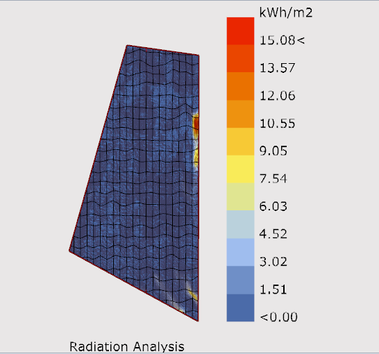
I’ve check everything: orientation, dimensions, location from epw for errors. File and rest of it is correct.
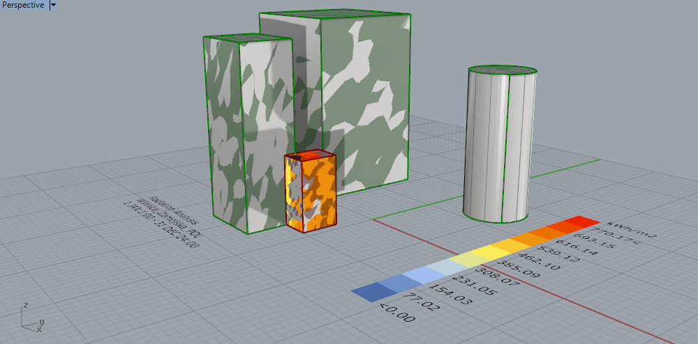
Even more curious thing – when I created simple geometry made of boxes and cylinders, values returned to proper numbers…
Can anybody of You help me with solving this?
Original Rhino forum link: https://discourse.mcneel.com/t/problem-with-geometry-real-life-terrain-vs-rhino-and-grasshopper/47580
Geometry file in the appendix.plot.3dm (277.2 KB)