I am a student from CITA studio in Copenhagen and fairly new to Butterfly.
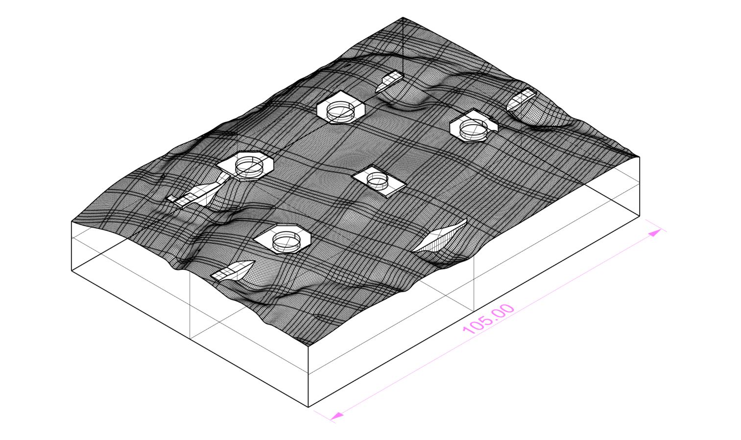
My whole project revolves around an old war site in Denmark and I would like to have model of the physical terrain (which you see in the attached image) and some kind of representation of the the wind flow on site.
I would like to be able to do an analysis for the current state of the site and for the state in which I am adding some obstacles to see how it is changing the behavior of the wind.
Since butterfly seems to be a lot about the meshing process and one of the outdoor airflow example files is already running pretty slow I would like to know if there is any way to simplify the process of simulating the wind behavior - simulating just section or similar.
Let me know if you have any ideas how to tackle this
From the image I’d say you’re almost there to achieving this.
The problem with uneven landscape is not really the landscape itself but how it intersects the bounding box. Without any additional treatment, OF and BF (currently) will not succeed in meshing a case like this since the sides will always be larger than they need to be.
A hacky way to avoid this (and it’s actually how I’ve done it in a couple of cases) is to generate a model like the one you have, only extended by quite a bit around your area of interest (e.g. 5km landscape). Then you need to manually pass that geometry to the intial (smaller) BF bounding box. To do that you would just need to replace it in the constant/triSurface folder.
If you go on meshing your case like that, OF will mesh using the large geometry and will automatically ‘cut it’ at the limits of your original case. If the geometry is closed, it will also create a proper bounding box that works.
p.s. might need a bit of trial and error to make it work, paraview is your friend here to visualize your bounding box after block Mesh and bringing your geometry in to test.
Did you manage to get this to work? I’m working on a project now that requires the same level of detail to include the topography, and was curious how you got on?
Also, use the Elk plugin (the older version, the newer is faulty in this) to import SRTM data of your area into Rhino/GH, at your site coordinates. This accounts for the larger terrain that influences the air flow. Meshing and selecting the area of interest is tricky, as the big terrain can cause things to slow down.
This is Julio. I am having a hard time trying to replicate your method to include a topografy into a CFD study. If I am not mistaken, I simply have to run the tunnel and block mesh which will generate the folder tri/Surface, there I have to replace the current stl file with one that also contains the topography. Once replace I can run the snappyHexMesh component, this will include the topography and the buildings in the mesh.
However, when I open the generated mesh with Paraview I can only see an empty tunnel with nothing inside. Could you please tell me where could be my mistake? Am I missing any step?