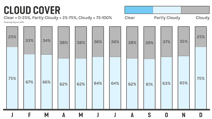
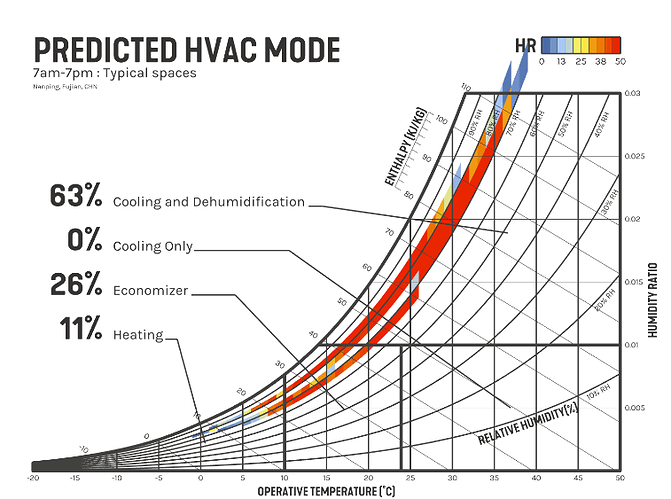
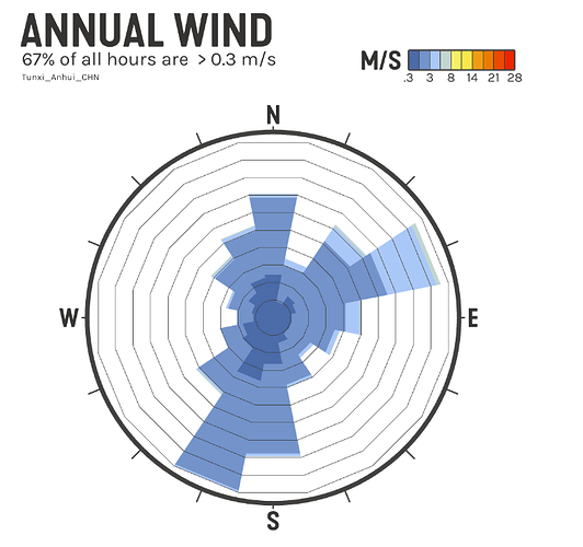
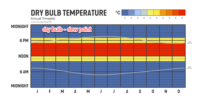
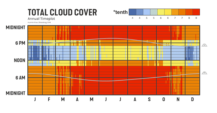
I’m simulating Chinese CSWD weather files and running into issues with the psych chart, cloud cover, and wind roses. These errors appear only in the CSWD files from OneBuilding. DOE files appear fine. I’m sharing my exploration of the CSWD data here so others are aware of the limitations.
I had a similar problem with cloud cover data from the tmyx.2004-2018 files from OneBuilding - see discussion here
I have confirmed that the same script works perfectly on tmy3 data. I have run this script on all CSWD files from OneBuilding and every one I checked has a similarly odd cloud cover chart, discontinuous psych chart, and low wind speed wind roses. I think the errors shown below are common to the entire CSWD dataset from OneBuilding.
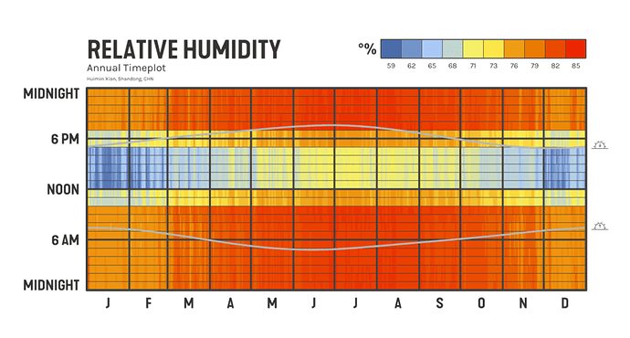
Problem 1: Dew Point Temperature values appear manufactured/incorrect. This error propagates through the Relative Humidity values.
Plotting relative humidity shows this data is wrong. Notice the vertical patterns are consistent but there are discontinuous breaks at 10am, noon, 5pm and 7pm. Calculating the RH from Dry Bulb and Dew Point temperatures resulted in the same incorrect RH errors.
Further exploration shows that there is exactly a 3, 4.5, or 6 deg C difference between the Dry Bulb and Dew Point temperatures, following the horizontal bands seen in the RH values. Comparison to trusted tmy3 weather files suggests the CSWD Dew Point temperature data is derived from the Dry Bulb temperature.
These errors result in the psych chart issues shown above.
Problem 2: Cloud Cover data is wrong and also appears manufactured
Plotting the cloud cover shows that it only includes values between 4 and 8 (representing tenths of the sky covered). It also suspiciously follows the same time bands as the RH graph. This makes me suspect the values are derived, not measured. Unlike the tmy3 cloud issues discussed in the linked post, this is not a problem of a different cloud cover classification. The bands make this data appear manipulated. Either way, it is totally wrong and should not be used.
Problem 3: Wind Speed
Exploration inconclusive. The OneBuilding files appear to have the same wind speed at the DOE files. There are no obvious errors that I can find. Values are oddly low. For a file I tested, 1/3 of the hours fall into the Beaufort Category 0 (Calm), over 90% of hours are category 3 or less (Gentle Breeze) and 98% are category 4 or less (Moderate Breeze). This doesn’t seem right but I can’t figure out any obvious causes.
Beaufort scale - Wikipedia
In conclusion, there are serious issues with the Dew Point Temperature, Relative Humidity, Cloud Cover and possibly wind speed values in the CSWD weather files hosted to OneBuilding. I recommend Ladybug remove these files from the EPW map and rely on the DOE files instead.
