Hi Ladybug team,
I wanted to share something I’ve been doing and see if it seems like a valuable approach for the Ladybug community. Currently, there is that extremely helpful EPW map that you can open from the canvas (EPW Map). I was interested in a way to where I could skip that step if I already have project coordinates leading me to make this little script that I’m positive could be cleaned up better than how I’ve done it.
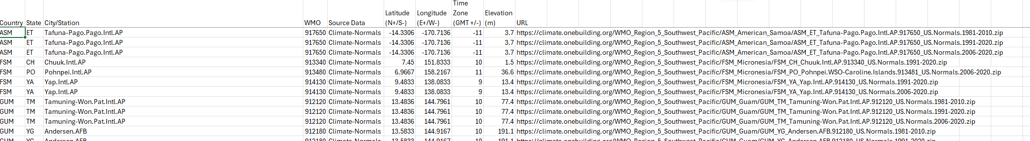
On the climate.OneBuilding website (WMO Region 4 - North and Central America) there is a section where you can download different regions EPW metadata as an excel file.
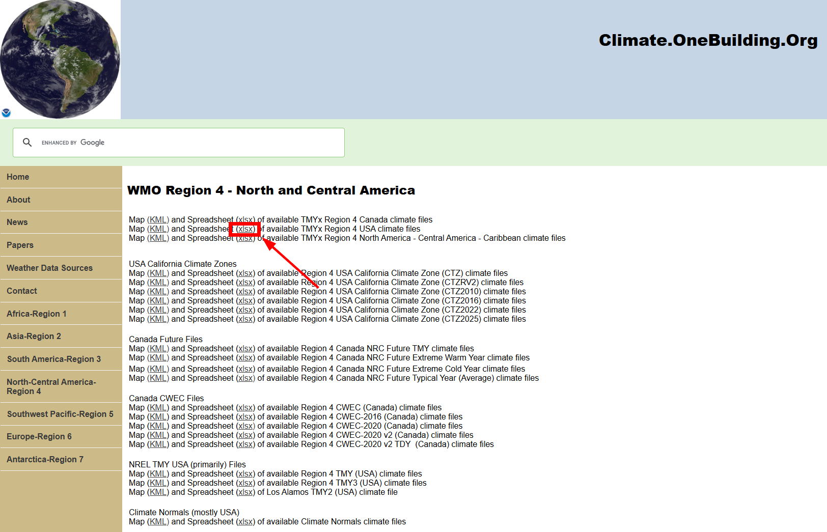
Two of the columns in that are the lat/long per epw file.
I basically just brought that data into grasshopper and then do the Haversine formula to find the closest file to my project and then return that files EPW URL.
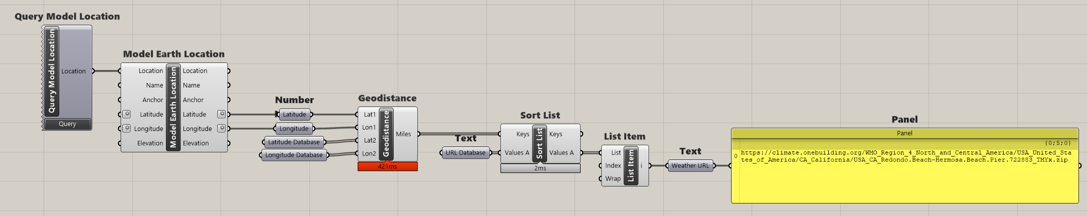
This is nice because I can just set the location in Rhino like normal and then my climate analysis can just kick off right away. Let me know what you think, thanks for reading and for the amazing tool you have built!
Here’s the file:
EPW by Coordinates.gh (223.4 KB)