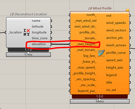
I have a question about the input for LB Wind Profile.
For _met_height_, should it be the elevation from the EPW file, or should it be taken literally as the “height above the ground at which the meteorological wind speed is measured”?
The reason I’m asking is this:
Suppose my project site is on flat land, but the only nearby weather station is located on a mountain. Naturally, the wind speeds measured at the mountain station are much higher.
If I input _met_height_ according to the literal definition — “height above the ground” — then the resulting wind speed profile will be extremely high, which seems unrealistic for referencing conditions at my flatland site.
However, if I use the elevation of the weather station (as recorded in the EPW file) as the _met_height_, the adjusted wind speeds appear more reasonable and better reflect expected conditions at my site.
Is this the correct approach?
