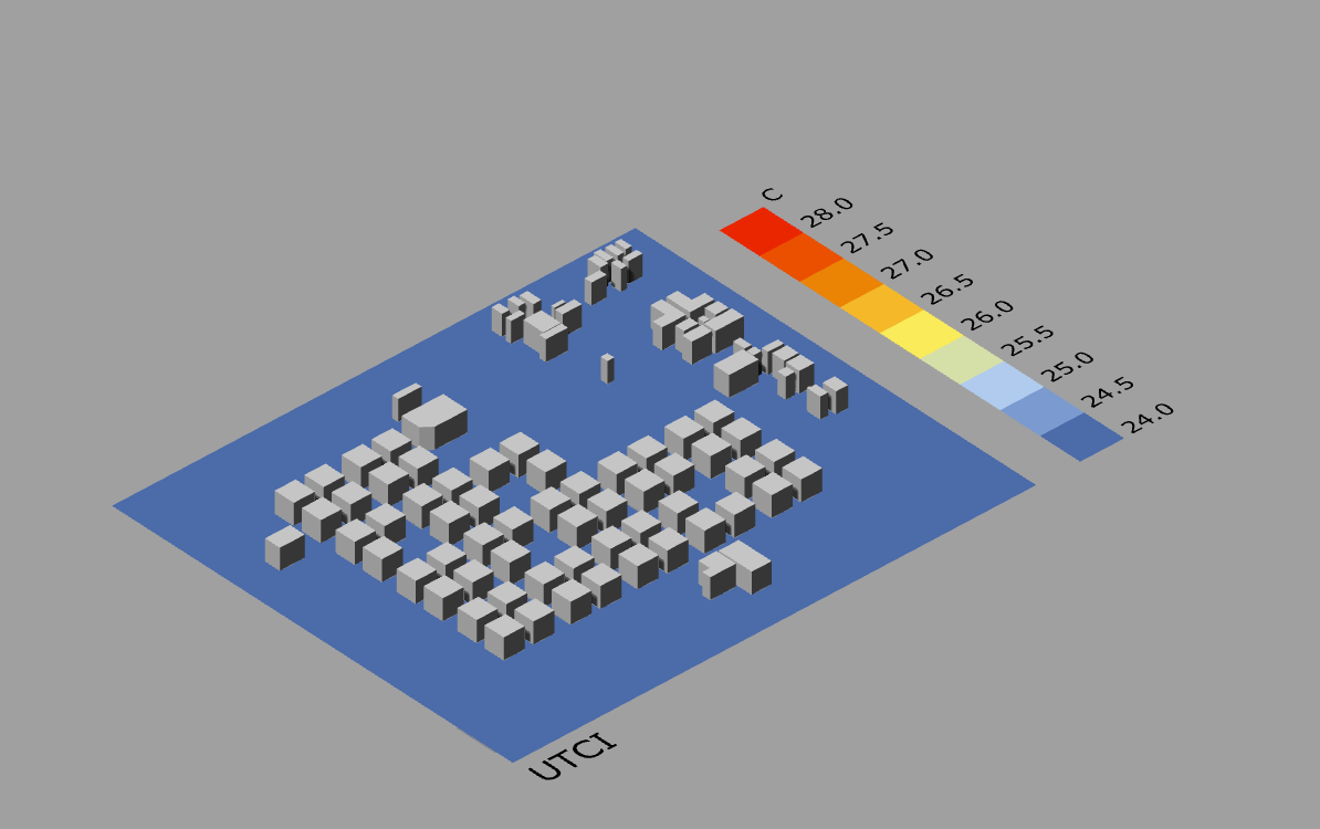
I have been exploring Chris Mackey’s Spatial UTCI map .gh definition for a project, but have been running into some problems. The first one is the amount of time the definition hangs; I have to leave the computer do its work overnight in order to get anything. When Rhino unfreezes, I get the following result:
The ladybug installation was performed correctly, so i don’t know exactly where else to look. I have attached the .3dm file and .gh definition on the following link:
Thank you Abraham. I checked the getmesh tool but can’t seem to locate which component extracts the plane’s normal. Which component are you referring to?
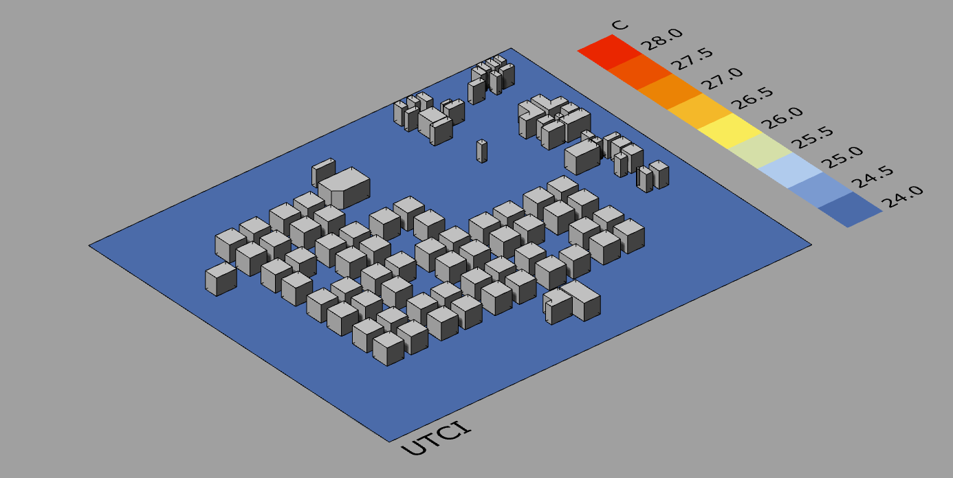
Thank you Abraham and sorry for the late response, the simulation just finished. The normal was indeed pointing downwards but, after switching it to point upwards, I get the same result, namely:
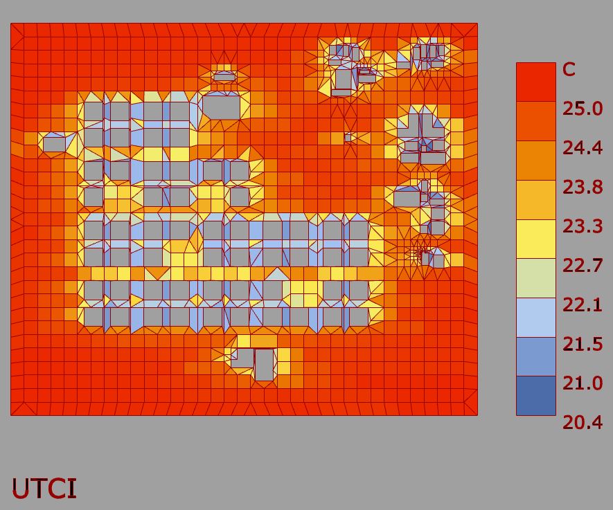
For the sake of time i changed the grid size. Consider if you need a so fine resolution. It will take a lot of time to calculate.
No need to set units to meters.