Because I am just starting to use the tool, I have some trouble to find a Switzerland Weather URL.
I am now doing a project for a water museum in Lugano, Switzerland and wanted to test the ladybug plugin on my project.
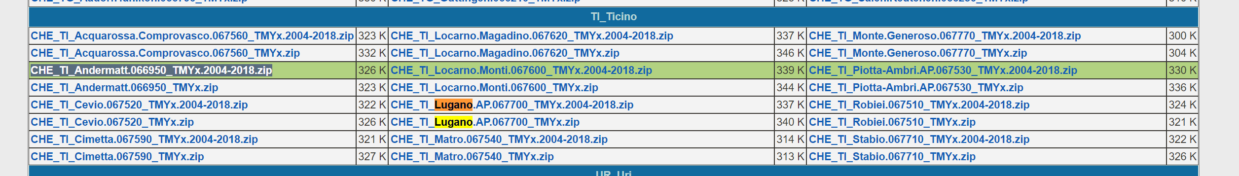
So far I found from the forum this website WMO Region 6 - Europe
Where I found some data
But I don’t know how to link it to Ladybug.
I was also reading in the this post in forum Drop down lists for Weather file URLs - #18 by mostapha (where the solution maybe) about this add-on that gives you automatically the URL if you write the City, but I guess Lugano, Switzerland is not in the database that has been used for the add-on. and I don’t quite get this part of the comments
Can anybody help me connect the data to ladybug, or does anyone know where I can find available public climate data for Switzerland?
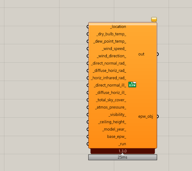
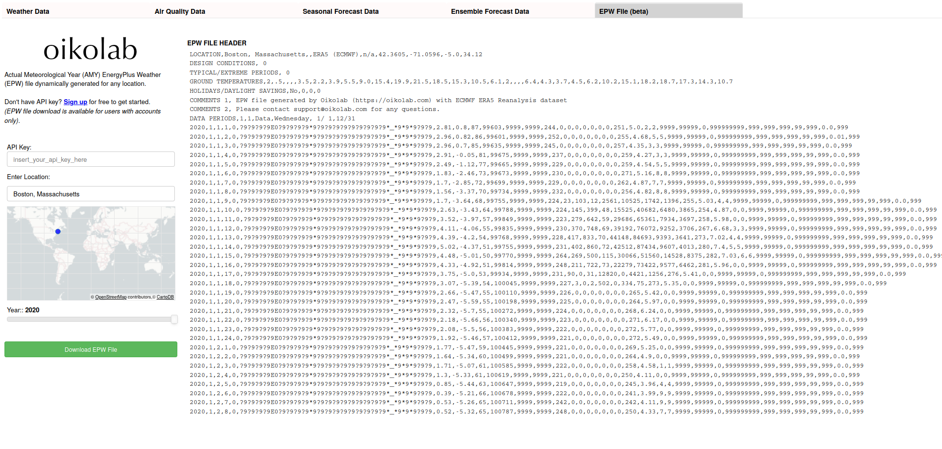
Most weather files are quite readable csv files. Important is that they contain for one year one value for each hour. So 8760 hours of data. With this dat you can make your own EPW file using Dragonfly.
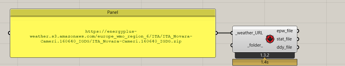
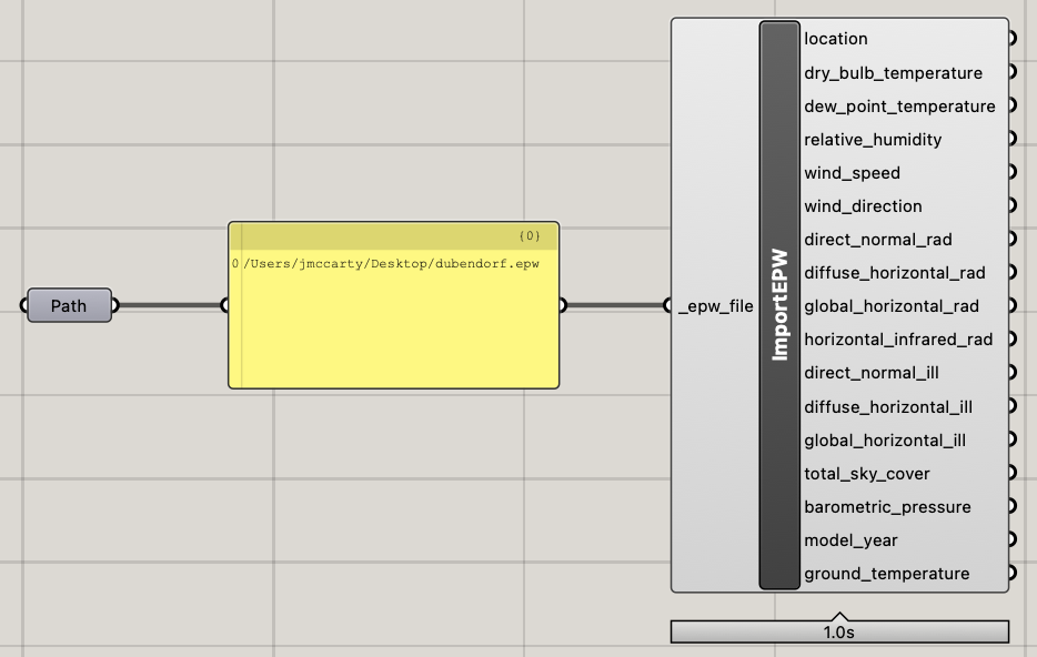
Those links contain zip files, which if you download and unzip will contain a .epw file. This is exactly the file you need for Ladybug. Once you have it unzipped you can import it into grasshopper using a file path component and the “import epw” component you downloaded with ladybug. There are some example files in the Hydra - Sharing made easy! but they may be a bit outdated. Best of luck!
I wouldn’t recommend this tool for Lugano (model elevation tend to be off for mountainous/valley regions) but for other cases, feel free to give this tool a try:
Hello @josephyang , why is that and can you describe the “border” where to the weather data downloader is usefull regarding mountains and valleys a little more detailed?
Background for my question is a case with a weather station relatively exposed close to the mountain top (800m) while the building is nearby in a side valley at 650m
As any hiker can tell you, weather in mountains and valley can vary quite substantially just by being on the opposite side of a peak even at the same elevation.
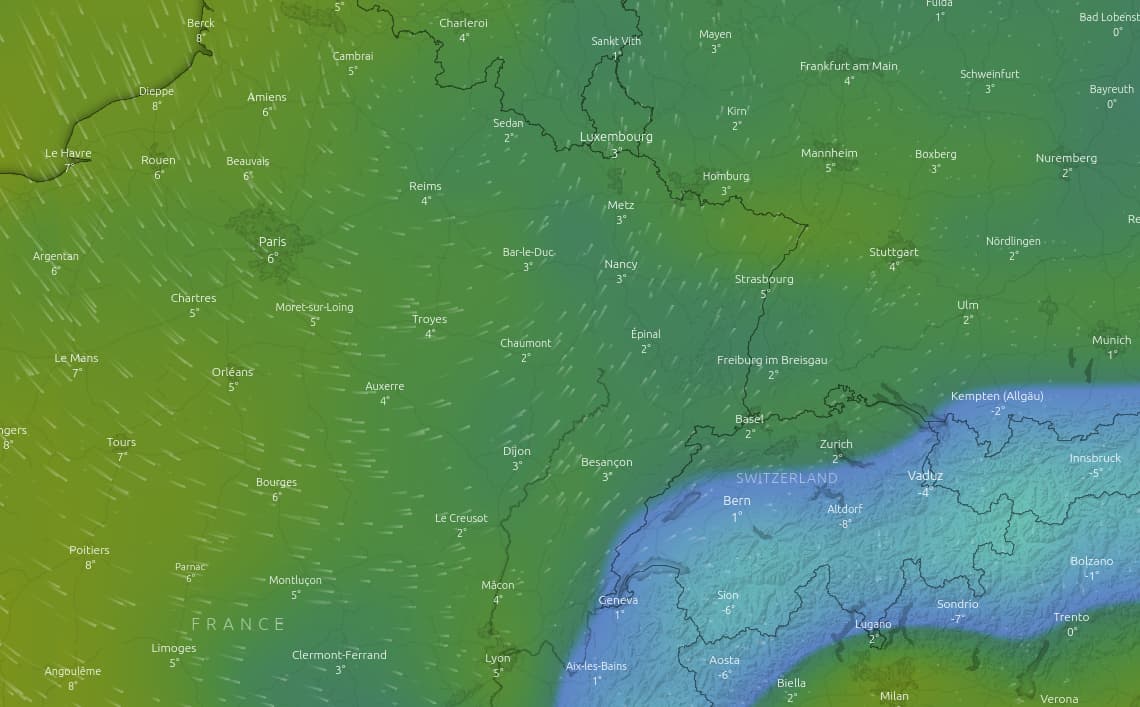
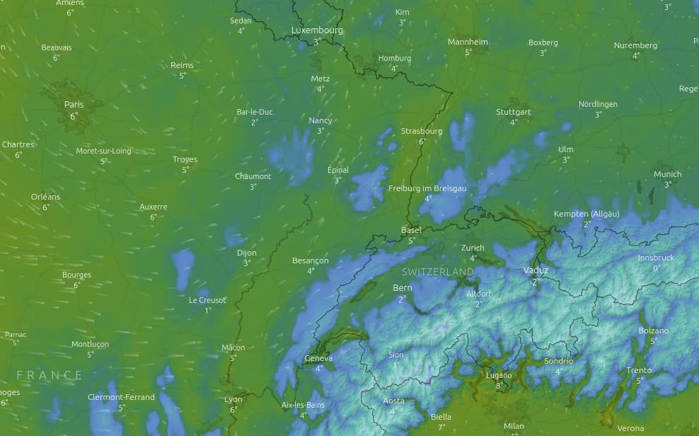
This particular dataset (ERA5 reanalysis) has horizontal resolution of about 28km x 28km so if the terrain varies substantially within this grid spacing, using the mean values of parameters for this area may not be too meaningful. For instance, here’s an NWP model (GFS from NOAA) with similar resolution as ERA5:
The key thing to note is that mountainous regions are resolved better with higher resolution model, although this doesn’t necessarily mean more accurate for all weather parameters (similar to how 100 megapixel cellphone camera doesn’t mean better picture than 20 megapixel Leica camera). However, if you look at other regions like Paris (top left) and Nuremberg (top right) you don’t see much difference between the 28km vs. 2km datasets because the terrain doesn’t vary too much in these places.
Going back to the initial question, the ERA5 dataset elevation for the region around Lugano is quite different than Lugano itself because ERA5 elevation is the ‘mean elevation’ of ~28km x 28km (roughly) grid of that region. I think it differs by almost 500m from the actual elevation (higher), resulting in a cold-biase. So to account for this, you might want to make adjustment for lapse rate and surface pressure at the least. If you have some background in meteorology, this isn’t too drastic of an adjustment to make but since most energy modellers are less familiar, the general recommendation is to just use weather data set if the model (or weather station) elevation and actual elevation are within 100m of each other.