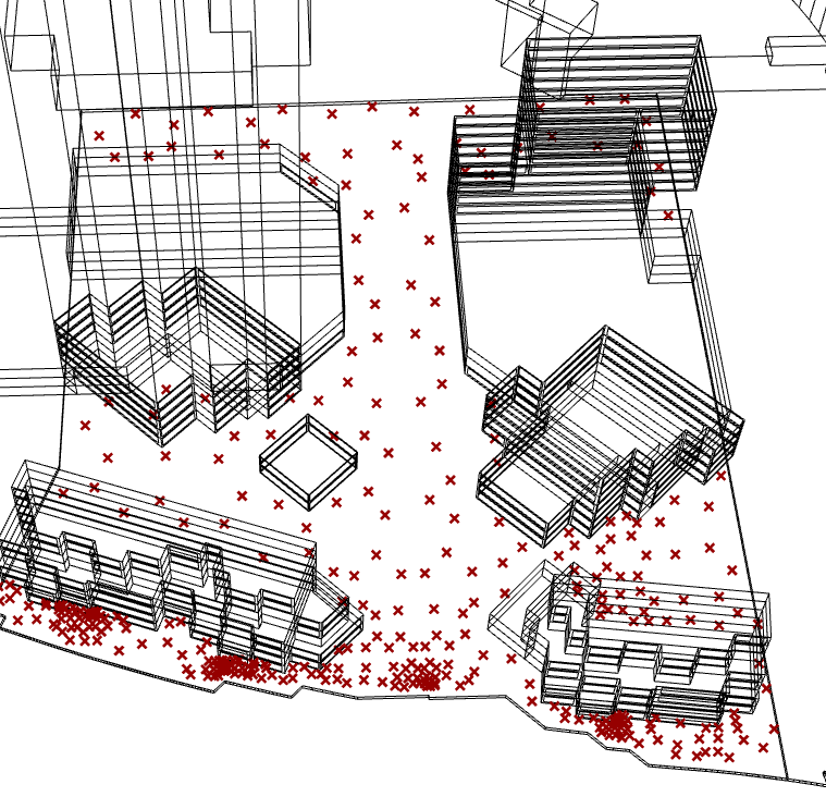
I am however not satisfied with the jagged edges of the analysis plane
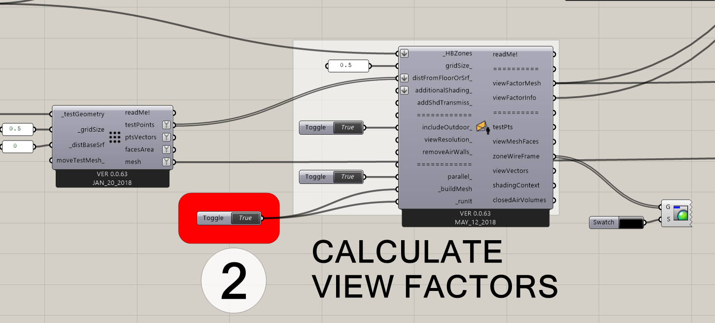
When I provide this surface to the distFromSrf_ input with a huge grid size of 15. it either freezes my machine or the view factor does not produce any results. Can you anyone suggest a remedy please?
@devang I would say that the jagged edges are totally fine for such analysis. If you want to be very accurate you can dine the edge cells and trim them against the perimeter curve.
@mostapha,
Thanks!
I also tried to get the edge curve of the jagged surface to aplit the original surface and add cells at the edge. However, I could not do that. I will try to DINE the edge cells. Will look it up.
@devang , @mostapha 's suggestion is a good one. I should also just enable people to plug in custom points instead of a surface to the view factor calculator. I’ll try to implement this soon.
After a lot of tests. I can report that, without having the capability to use a list of points, whenever there’s a case where the surface points are not in a grid. The view factor component is not useful. This specifically applies to the outdoor UTCI studies. Did no body report this before? That cannot be.
@devang ,
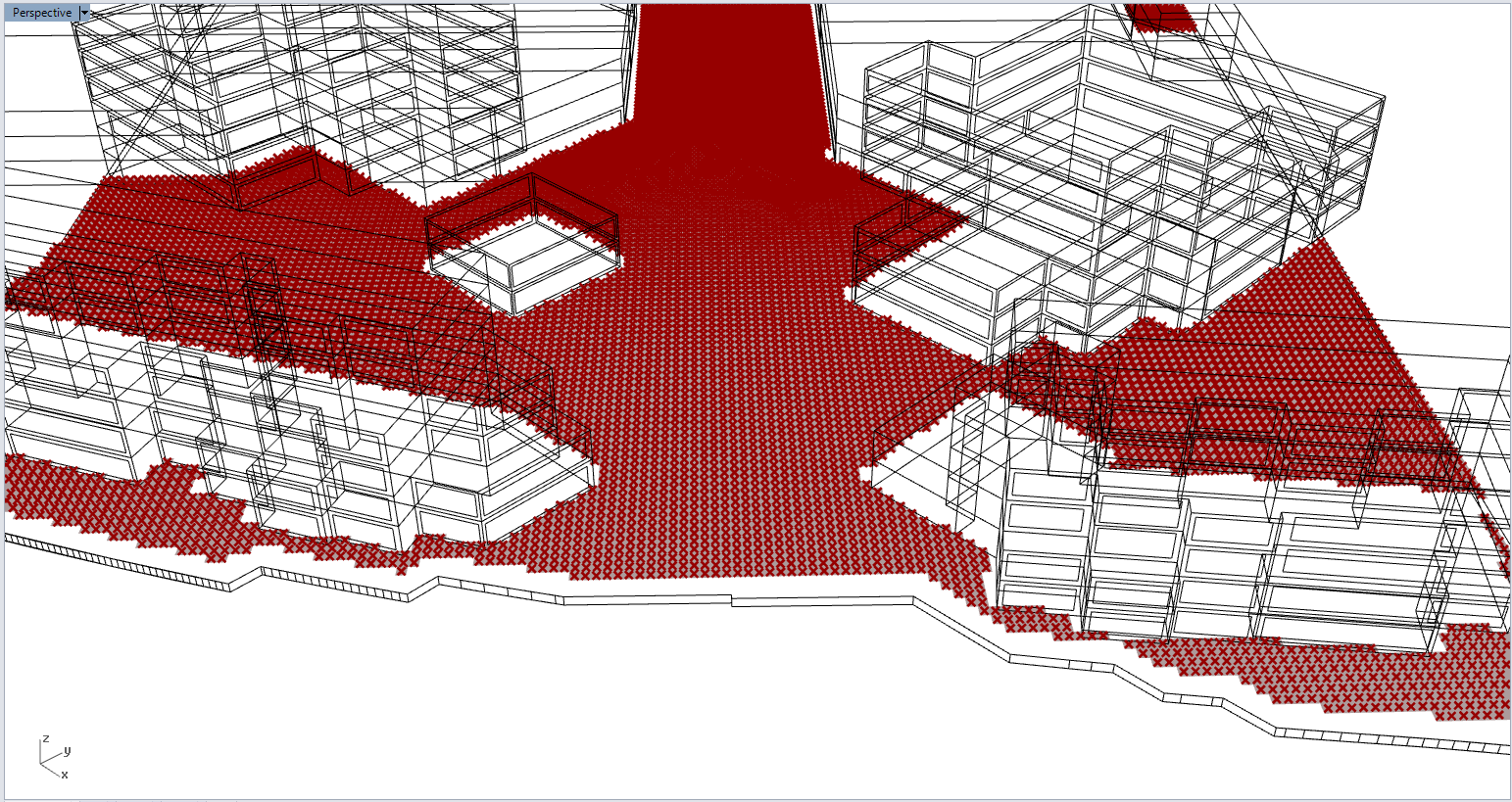
Thanks for investigating this. Because of your issue here and because I have had several people tell me that they want this feature, I have added the ability to plug custom points into the viewFactor component like so:
The way I coded it, the component will basically try to generate its own viewFactorMesh from the points, which may not result in as nice of a visual as if you had plug in a surface. However, you can take the data and re-color your original mesh for your case here. An important caveat of this is that the viewFactor component splits the points up based on the zones that they belong to (so that it can use the right zone data to figure out the microcliamte conditions). So it will be hard to re-align data with an original mesh if it spans over multiple zones or in between the indoors and outdoors. For a single zone or for a bunch of points that are all outdoors like your case, it should be fine, though.
Dear @chris,
I took some time to test this. I can totally work with this. Thanks a lot for quickly implementing this. I could say with surety that with this newly added capability will be highly used by people working towards producing high-accuracy UTCI maps.